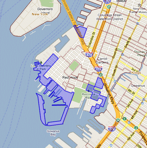
The NY Dept of Health released the latest figures for cancer in New York State. It is in the form of an interactive map where you can click on an area and see the amount of cancer cases since 2000 as well as the population.
Zoom into the Brooklyn area and click the “Identify” button to activate the areas. Then you can click on an area to see the numbers.
I immediately looked at the areas around the Gowanus Canal. The old locals say that area has higher rates of sickness. But to my surprise the number of cancer cases around the canal was no greater than other areas in Brooklyn.
What did surprise me was that Red Hook had high rates. For example a typical area in Brooklyn may have 25 cancer occurrences in 1000 people which is 2.5%. If you click around you will see this number is pretty constant.
But the coast of Red Hook has 26 cancer occurrences out of 208 people. That is a whopping 13%. It is strange that only 208 people are listed but that is a pretty barren area. See below for the area I’m talking about.
These numbers are still raw data. So for example a hospital in an area will show the area to be very elevated and you won’t know why.
But the Red Hook info is worth looking into further. It is coincidentally bordering on the Red Hook Park that has been in the news lately for being highly toxic. Interesting….Summer is coming, anyone up nice picnic on the Red Hook Park lawn?

